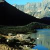
The elevation gain along Johns Lake Trail is 160 feet.

Length: 0.4 miles.Trail Begins: Avalanche Trail.Trail Ends: Going To The Sun Road

USGS Map1: Park Map

Lake Josephine Trail is accessed by a paved footpath from the upper Swiftcurrent boat dock and runs west to the foot of Lake Josephine where it continues around the north shore of the lake as a dirt trail. At midpoint along the lake, a trail to Grinnell Glacier turns and climbs to the west.

Kintla Lake Campground is located in Glacier National Park in northwest Montana near the Canadian border. At an elevation of 4,500 feet, the campground encompasses 2 acres.

The Kishenehn Creek Trail is 4.0 miles one way. Mostly level, two creek crossings.

Length: 4.5 miles.Trail Begins: Kishenehn Ranger Station, Trail Junction 7.Trail Ends: International Boundary

USGS Map1: Park Map

Lake Isabel can be accessed by hiking the trail departing from the north end of the Walton Ranger Station complex, which is located on US Highway 2 at the southernmost extremity of the park

Lake McDonald Cabin

A private residence on Lake McDonald inside Glacier National Park. Enjoy the comfort and privacy of your own cabin with a stunning view of Lake McDonald and the mountains surrounding Going-to-the-Sun Road.

Lake McDonald Lodge (On Lake McDonald)

Built in 1913 as a hunting lodge, Lake McDonald Lodge presents the same comfortable, homey atmosphere now as it did when originally built by John Lewis. Lewis, a furrier, collected all of the hunting trophies, which are still displayed in the lobby.

The Lake McDonald Ranger Station is located at Fish Creek Campground or 2.8 miles west on North Lake McDonald Road, and then two miles to Kelly Camp. From the campground, the trail follows the lakeshore to the southwest, reaching the Camas Road near Fish Creek. Seldom used. Hard to find.

Length: 6.0 miles.Trail Begins: Chief Mountain Road.Trail Ends: Gable Pass

USGS Map1: Park Map

Length: 2.0 miles

Trail Beginning: Old Flathead Ranger District.Trail End: Road, end of trail.

USGS Map1: Park Map

Lincoln Lake Trail-NPS

Lincoln Lake Trail is a moderately strenuous hike begining with a steep steady climb up Snyder Ridge. At 4.4 miles the trail reaches the junction with the Lincoln Creek trail. Turn left for Lincoln Lake. Trail continues gradually uphill untill reaching Lincoln Lake.

Logan Pass Visitor Information Center

A must-do trip to drive across the Continental Divide on Going-to-the-Sun Road. This 55 mile road is the only one that bisects the park. Start at either West Glacier or St.

Logging Lake Trail-NPS

Logging Lake Trail follows the north shore of the lake. Stay left at the 4.9 mile junction. You will find a patrol cabin at this point, stay to the left. At Lower Logging campground trail, stay to the left. At 9.8 miles you will reach Adair Campground.

At 0.1 mile there is a trail sign beyond old Nyack Ranger Station, turn left for Loneman Lookout. The trail runs westward, following the Middle Fork, and then at .8 mile there is a junction with Nyack Creek trail after the bridge over Nyack Creek. Stay left for Loneman Lookout.

Many Glacier Campground

Many Glacier Campground is located on the east side of Glacier National Park in northwest Montana at an elevation of 4,500 feet. The campground is near Swiftcurrent Lake at the end of the Many Glacier Road.

Many Glacier Hotel (Many Glacier Valley)

Many Glacier Hotel, built in 1914 and 1915, is the largest hotel in the park with 208 rooms. Its design was modeled after Swiss chalets and the Swiss theme is carried throughout the hotel, most notably in the main dining room, which features the flags of Switzerland's Cantons.

Martha's Basin Trail is actually the access trail for Buffalo Woman Lake and Beaver Woman Lake. It 's trailhead begins at the headwaters of Coal Creek off of the Coal Creek Trail. After traveling one mile pass the Martha Basin junction there is a fork in the trail.

McDoanld Creek Trail follows along the creek for 3.4 miles, passing above Sacred Dancing Cascades. Another trail runs from the Snyder Creek trailhead for 5.8 miles to Avalanche Campground.

Length: 4.0 miles.Trail Begins: Packers Roost.Trail Ends: Flattop Trail

McDonald Lake Trail-NPS

From the campground, Lake McDonald Trail follows the lakeshore to the southwest, upon reaching the Camas Road near Fish Creek.

Length: 8.7 miles.Trail Begins: Apgar.Trail Ends: North Lake McDonald Road

USGS Map1: Park Map

Medicine Grizzly Lake Trail climbs along the North Fork of Cutbank Creek. At mile 1.1, there is a junction to the old chalet road, stay to the right for Medicine Grizzly Lake and Triple Divide Pass. The Triple Divide junction will be at 3.9 miles.

Pages

Subscribe to Glacier National Park