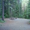
The Camas Creek Trail is a lightly maintained trail that runs through meadows of tall grasses and Douglas-fir woodlands to Trout Lake. It is a favored route for horseback packing accessing the Camas Creek Valley.

Length: 13.9 miles.Trail Begins: North Fork Road.Trail Ends: Camas Lake

Coal Creek can be reached by starting at Nyack Creek ford at the north bank of the Middle Fork of the Flathead River. From Nyack Creek to the junction with Cutbank Pass Trail and Coal Creek it is approximately 17 miles.

The Cosley Lake Trail can be accessed from Chief Mountain Customs trailhead, located on Montana State Highway 17, within sight of the Border Patrol buildings.

Crack Flats Horse Trail winds around the base of Allen Mountain at .8 mile into the hike. At 1.3 miles you will find junction with Cracker Flats horse trail. Stay right for Cracker Lake .

Cracker Lake Trail winds around the base of Allen Mountain at 0.8 mile into the hike. At 1.3 miles you will find junction with Cracker Flats horse trail. Stay right for Cracker Lake.

Cut Bank Pass Trail ascends, following the North Fork of Cut Bank Creek. Hike 0.1 mile to junction with old Cutbank Chalet access road, stay to the right for Morningstar Lake.

Dawson Pass Trail junctions at 3.3 miles leading to Twin falls and the south shore trail. Stay right for Dawson Pass. At 4.8 miles junction with trail to No Name Lake and campground (.2 mile), stay right for Dawson Pass. Trail then ascends steeply to Dawson Pass.

Divide Creek Trail runs over a low spur ridge of Curly Bear Mountain. The trail provides a popular cross-country ski route in wintertime, however it is a primitive trail, with a high incidence of grizzly bears during summer. This trail should be avoided in summer.

Dry Fork Trail follows the north side of Two Medicine Campground. The trail junctions at 3.3 miles leading to Twin falls and the south shore trail. Stay right for Dawson Pass. At 4.8 miles junction with trail to No Name Lake and campground (.2 mile), stay right for Dawson Pass.

Elk Mountain Trail can be accessed from US Highway 2 and by taking the Fielding-Coal Creek Trail.

Length: 2.5 miles.Trail Begins: Fielding Trail.Trail Ends: Top of Elk Mountain

USGS Map1: Park Map

Feather Plume Cutoff trail provides a link between the Piegan Pass trail and the Upper Grinnell Complex. The trail trail climbs below the eastern wall of Angel Wing from Grinnell Lake.

Length: 3.0 miles.Trail Beginning: Camas Road.Trail End: End of Trail

USGS Map1: Park Map

Fielding-Coal Creek Trail links the drainages of Bear, Ole, Park, Muir, and Coal creeks several miles above their confluences with the Middle Fork.

Firebrand Pass Trail begins at a false summit near Marrias Pass and on the north bank of the Coonsa Creek . It follows the creek for about 0.5 mile and then veers north climbing slightly to a junction with Autumn Creek Trail.

Fischer Outdoor Discoveries

Fischer Outdoor Discoveries (FOD) specializes in small group tours to see wolves, bears and other wildlife. We lead annual trips to Yellowstone and Glacier National Parks.

Fish Creek Campground

Fish Creek Campground is located in Glacier National Park in northwest Montana. At an elevation of 3,500 feet, the campground encompasses 12 acres. This is a fully accessible campsite for the disabled. Restrooms and drinking water are provided.

Flattop Mountain Trail begins at Packer's Roost, (a trailhead and old cabin, on a short spur road, off the Going-to-the-Sun Highway). It is located 23 miles east of West Glacier.

At mile 4.0, Florence Falls Trail leads off to the west, climbing gently to the base of Florence Falls. The Falls is created by the hanging valley of Twin Falls.

Length: 0.8 miles.Trail Begins: Gunsight Pass Trail.Trail Ends: Florence Falls

USGS Map1: Park Map

Length: 6.1 miles.Trail Begins: Belly River Ranger Station.Trail Ends: Otatso Creek Trail Junction

USGS Map1: Park Map

Length: 0.8 miles.Trail Begins: Highline Trail.Trail Ends: Grinnell Glacier Observation PT

USGS Map1: Park Map

Pages

Subscribe to Glacier National Park