Quartz Flat Campground is located in the Lolo National Forest in northwest Montana. At an elevation of 2,900 feet, the campground encompasses 40 acres. Handicapped-accessible restrooms and drinking water are provided for the 52 campsites. Fishing may be enjoyed on the Clark Fork River nearby.

Rainy/Dominion Snowmobile Trail offers high altitude snowmobiling. There is a parking capacity of 15 cars.

Length: 15 miles of marked and groomed trails.Trail Beginning: Taft Exit.Trail End: Loop

Area Map: Superior Area Snowmobile Trails

ROW (River Odysseys West) has been a leader in adventure travel since 1979. We offer rafting, canoeing, and raft-supported hiking adventures in Idaho and Montana.

River Trail (223) is an excellent hiking trail with a variety of views, habitat and topography. Parts of the trail follow the Clarkfork River, while other sections wander away from it. There is one stretch along a rock outcrop across a talis slope that should be crossed with caution.

Rugg's Outfitting L.L.C. is a full service year round outfitting family involving 3 generations. Since 1947 we have been providing western experiences for people of all ages.

Savenac Creek Trail (263) is a nice trail along a creek bottom for several miles. Then it climbs through excellent elk and other wildlife habitat to the CC Divide Trail.

Length: 6.5 miles.Trail Begins: Forest Road 3811.Trail Ends: CC Divide at Mount Bushnell

Sheep Mountain Lodge

Sheep Mountain Lodge is located on twenty private acres off Interstate 90, between St. Regis and Superior, Montana, on the banks of the beautiful Clark Fork River. We offer Bed and Continental Breakfast, featuring four unique guest rooms with either private or shared baths.

Sunday mass 11:30am. Wednesday 5:00pm.

St. Regis Lakes Trail

St. Regis Lakes Trail (267) is an all season area with splendid views of alpine country and flora. If cross-country skiing check with the Forest Service; or Friday-Sunday, the Avalanche Advisory 1-800-281-1030; or the Lookout Pass Ski Area.

Originally a meandering trail which followed the Clark Fork River between St. Regis and Paradise, the St. Regis-Paradise National Forest Scenic Byway lies within the Lolo National Forest.

State Line Trail (738) offers numerous vantage points to view alpine lakes, river valleys and unbroken forests in both Montana and Idaho

It is closed to motorized vehicles.

Length: 18.3 miles.Trail Begins: Forest Road 342.Trail Ends: Forest Road 734

Storm Peak Trail (255) is mostly a ridge trail. There are good views of the Ward/Eagle Peak area and alpine lakes.

Length: 9.8 miles.Trail Begins: Haugan.Trail Ends: State Line Road 391

Sunset Creek Trail (234) is a good hike on a hot summer day as the trail is in a wooded, shady area for the first mile and crosses five creeks.

Length: 3.2 miles.Trail Begins: Forest road 221.Trail Ends: Dry Creek Divide Trail 203

Superior Community Church was established in 1976 in the beautiful Clark Fork valley. Sunday school is every Sunday at 9:45am and worship service is at 11:00am - 12:30pm. Everyone is welcome.

Thompson Creek Trail (173) is a lower elevation trail through Lodepole Pine. It is a popular hunting trail.

Length: 11.0 miles.Trail Begins: Forest Road 304.Trail Ends: Sheep Mountain

There is a $30 a night usage fee. The cabin will accommodate up to four people. Drive directly to the tower. Microwave, refrigerator, and heat provided. Renters must furnish their own water.

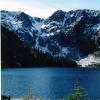
Trail Lake Trail (156) follows the creek fomst of the way to a beautiful high mountain lake. The lake elevation is 5,720 feet and thte trialhead is at 4,800 feet.

Length: 4.9 miles.Trail Begins: Forest Road 388.Trail Ends: State Line Trail 738

Trout Creek Campground is located in the Lolo National Forest in northwest Montana. At an elevation of 3,000 feet, the campground encompasses 6 acres. This a basic forest campground with 12 campsites, restrooms and drinking water provided.

Trout Creek Driveway Trail (169) features some outstanding views of the State Line Trail along the divide between Montana and Idaho as well as the Cedar Creek and Trout Creek drainages. It gets you right up there in the high country.

Four person capacity; cost $25.00. This is a fairly steep trail that follows a prominent ridge the entire way. The elevations difference from the trailhead to the peak is 2,770 feet. Features include good vistas of the St. Regis River Valley, geographic changes and the Up-Up Fire Lookout.

Pages

Subscribe to Superior