- Home
-
Places To Stay
-
Search
-
-
Contact Us
-
Contact Us
-
-
Activities
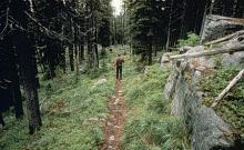
McGuire Mountain Trail is an easy hike with very few steep pitches. It follows McGuire Creek for the entire length and is close to the creek the last 2 miles. Trail length depends on snow plowing of access road. Limited parking.
Length: 5.6 to 15.1 km of more difficult trail; no grooming. .Trail Begins: 0.3 mile up McGuire Creek off Highway 37.Trail Ends: Upper fork of McGuire Creek
Area Map: Kootenai National Forest Visitors Map .USGS Map1: Inch Mountain .USGS Map2: McGuire Mountain.Township 34N; Range 28W; Section 22
SiteType:
County-City:
Website:


